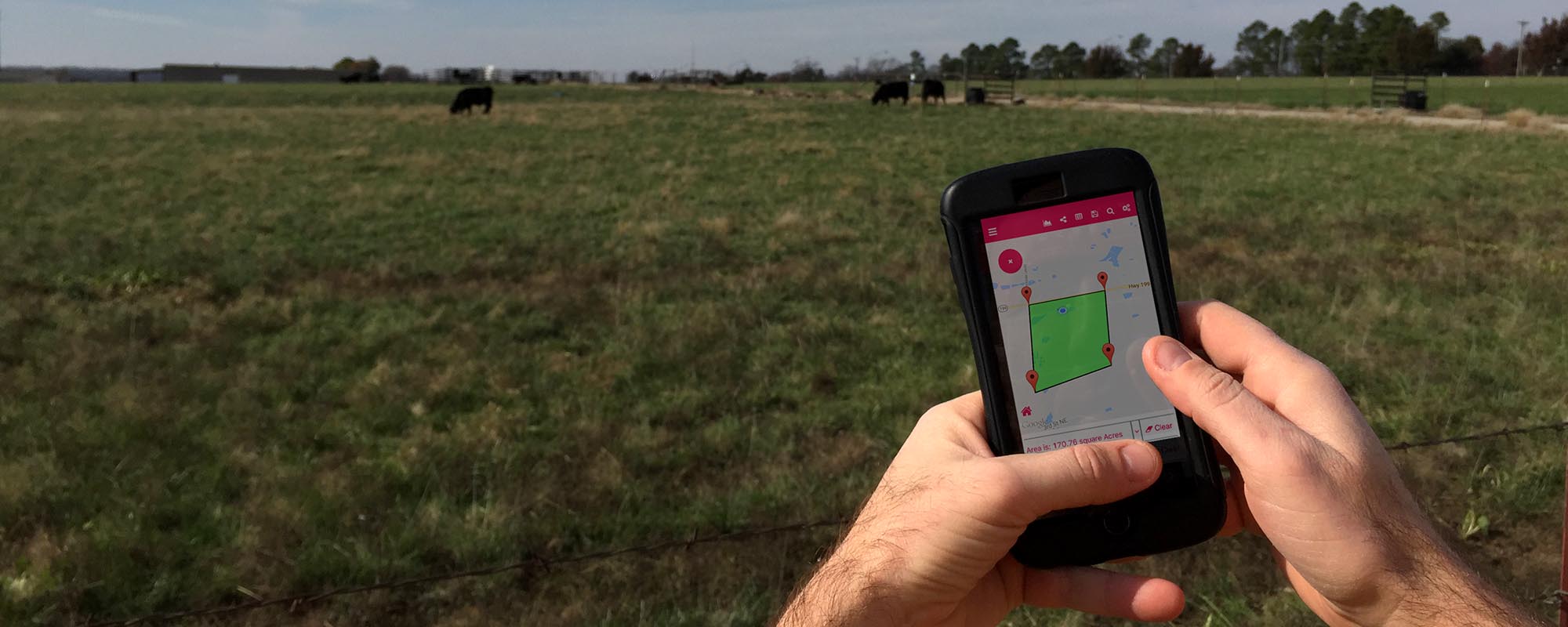
How big is that pasture? How long is this fence line? How far is it to the nearest water point? All of these questions and more can be answered using the GeoMeasure application, a free download for both iOS and Android smartphones.
Knowing the area of a pasture or field is very useful information, especially when calculating application rates of a sprayer or determining stocking rate. GeoMeasure allows you to assess area in a multitude of units including square feet and acres. Users have two options to retrieve the area of a determined space: manual measurement, which entails dropping markers on your device's screen, or measurement by GPS, which simply means the device tracks your movement as you walk the perimeter of the given area. I have found the second option to be more precise because I cannot achieve the same level of accuracy dropping markers with my finger on the phone's screen. Much like Google Maps or the built-in map function on your phone, users can also choose from four map layouts: normal, satellite, hybrid or terrain.
The app also measures distance with remarkable accuracy. Once again, users can choose from a variety of units including feet, meters and miles. As with area calculations, users can choose from either a manual or GPS measurement. After you are done dropping markers on the map or walking the distance in question, the application totals the distance and displays the final reading at the bottom of the screen. From there, you can clear the measurements and start over; save the measurements as a photo on your phone; or share them via email, text message or through social media. This information can be quite handy to have when estimating the cost to build a fence or road, lay a waterline, or simply calculate how far livestock have to travel to water. GeoMeasure also tracks and provides elevation change along a given route or in a certain area.
I really like the functionality and overall design of the app, as well as the built-in tutorial and ability to offer suggestions to the developer for future features and updates.
One interface I have not used is the ability to import a Keyhole Markup Language (KML) file, a format used to display geographic data in an Earth browser such as Google Earth.
While there is no charge to download or use the application, users will notice an abundance of advertisements around the border of their screen as well as the occasional pop-up ad. There is an option to remove ads for $2.99. While nominal, I choose to look past the ads and continue to use the free version.
The next time you need to measure something, leave the tape measure in the toolbox and use your phone.